|
December 11, 2008
Experimental representation of HPWREN activities in Google Earth
To demonstrate some of the scope of HPWREN and its use via project
partners, an attempt was made to map some of the activities via
multiple approaches into geographical information via the kml
format which Google Earth utilizes. While this proof-of-concept
article is focused on network applications and the scope of its
cyberinfrastructure, this could also eventually include geographically
mapped network performance data.
Please note that the locations are approximate-only, most are
rounded to two digits after the decimal point, and they are not
guaranteed to be accurate. This also may collapse multiple entities
in fairly close proximity into a singular location.
Also, to try the examples below, it is highly recommended to use a
new version of Google Earth and turning off other layers.
|
|
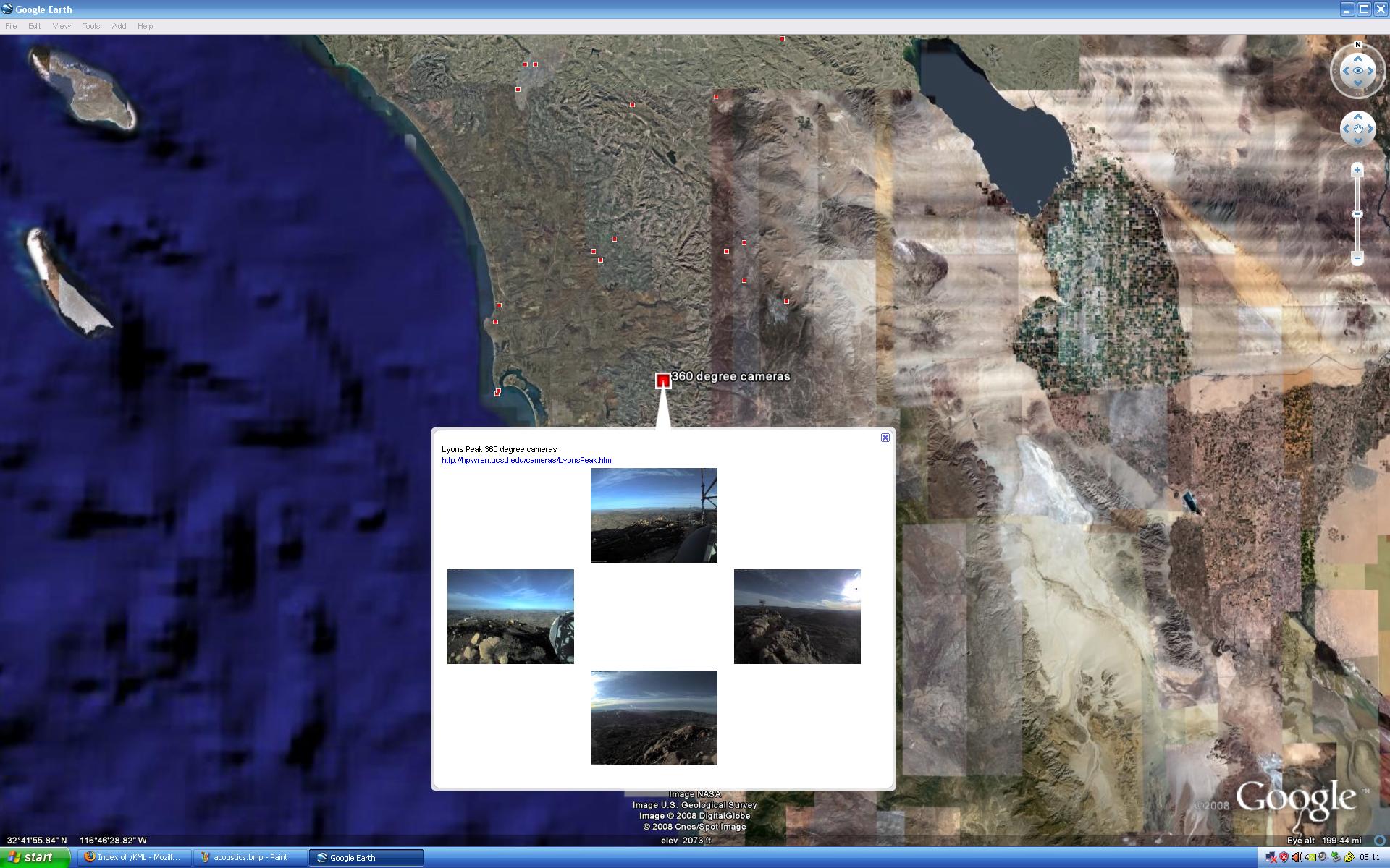
http://anr.ucsd.edu/Viz/KML/cameras.kml shows locations of network
cameras connected via HPWREN. The specific example used here shows
the 4-camera 360 degree view around Lyons Peak, while importing
real-time images. Clicking on the individual small images will provide
the originally sized version at 1600x1200 pixels.
|

|
|
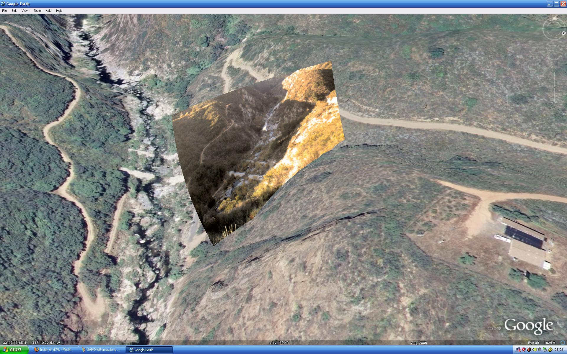
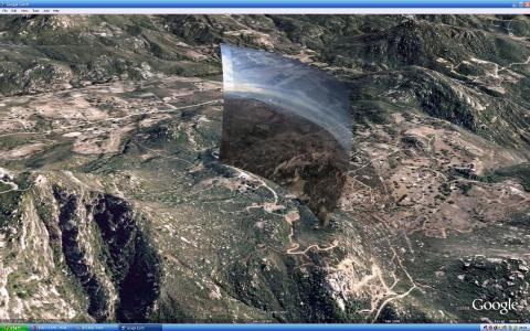
http://anr.ucsd.edu/Viz/KML/SMER-Gorge.kml takes a different
approach by mapping a river gorge camera at the SDSU Santa Margarita
Ecological Reserve as a photograph projected onto something resembling
a canvas in the landscape. While the projection of this and other
images in this article is not entirely accurate, it allows for
somewhat of a comparison between the archived image base which Google
Earth provides, and real-time photos.
|
|
|
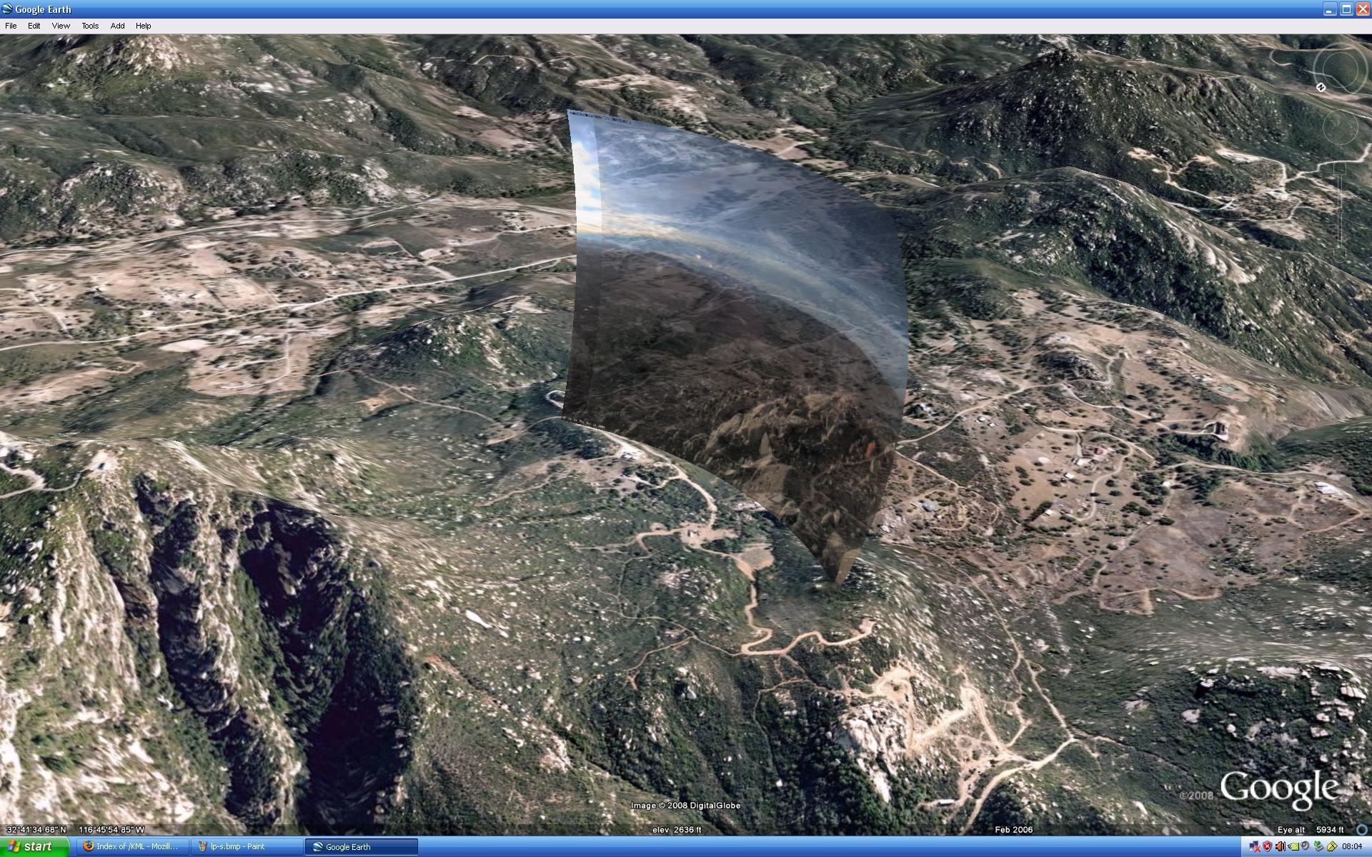
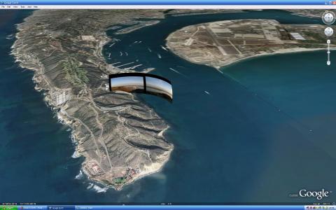
While
http://anr.ucsd.edu/Viz/KML/LP-pan.kml projects all four real-time
cameras (clickable under "Places"), the example shown here only uses the
south-pointing one, with the image rendered somewhat transparent via the
slider under "Places."
|
|
|
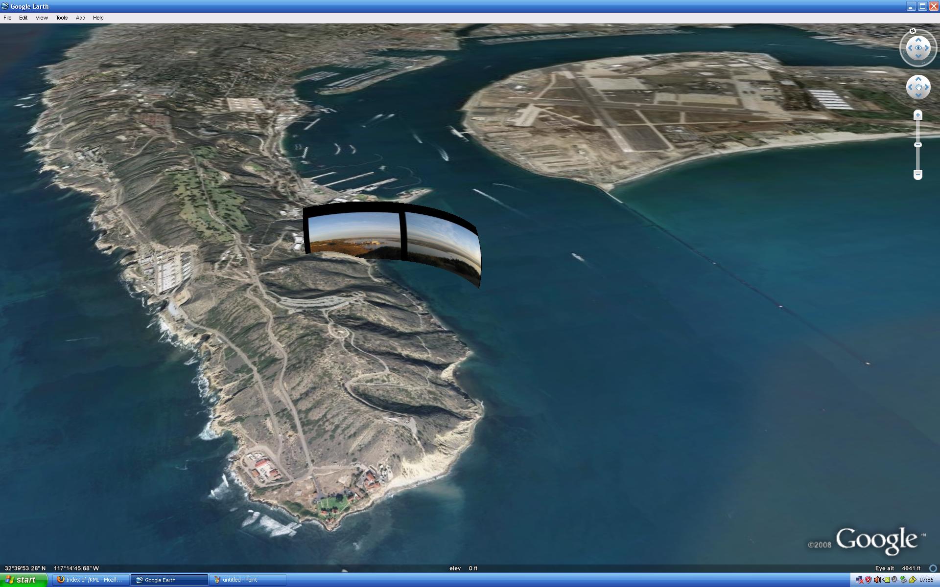
The images of the ten and twelve megapixel NPS Cabrillo National
Monument cameras at
http://anr.ucsd.edu/Viz/KML/CNMVCSD.kml are generated once per
hour. They are, however, so large, that it is not realistic to display
them as single images (like in the previous example). Instead, an
automated process creates about 340 image components per photo, after
new ones arrive, so they can be used as an image pyramid in
Google Earth. This allows for fast loading and fast zooming in the
viewer.
|
|
|
The non-real-time
http://anr.ucsd.edu/Viz/KML/MPOpan.kml takes the image
pyramid further by using 2,749 component images for the large
canvas the photo collage is projected upon. This was created from the static
images taken up on the water tower at the Palomar Observatory.
The April 12, 2008 entry at
/iotw-2008.html provides access to the
original almost 44 megapixel version.
|

|
|
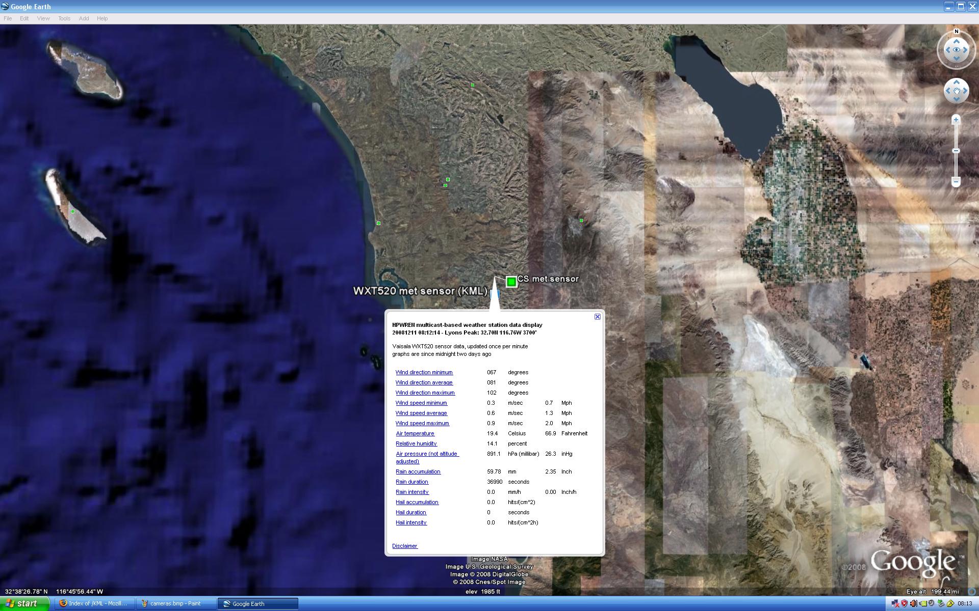
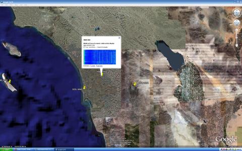
http://anr.ucsd.edu/Viz/KML/met-sensors.kml provides access to
real-time meteorological sensor data. The example shown displays data
from a Vaisala WXT520 sensor on Lyons Peak, that utilizes a
kml file, which is updated once per minute. Bubbles from the
other sensors typically refer to real-time data on a web site.
|
|
|
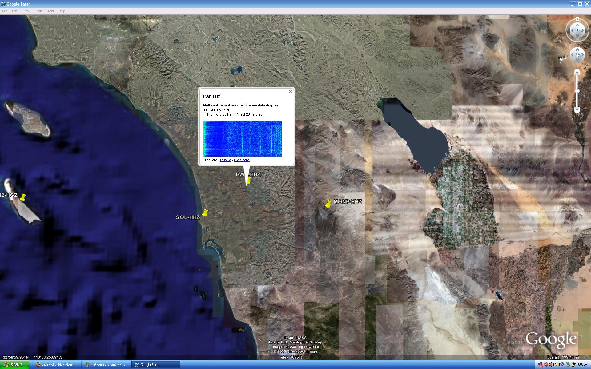
An experimental means to show raw seismic sensor data as FFT
thumbnails is available at
http://anr.ucsd.edu/Viz/KML/seismic.kml, while using raw Z-axis data from a
subset of the UCSD/SIO ANZA seismic stations that is being distributed via
multicast on HPWREN. This is more of an attempt to show data use beyond
seismic information, as generated by the highly sensitive instrumentation,
and displays the last 20 minutes prior to generating the graphic.
|
|
|
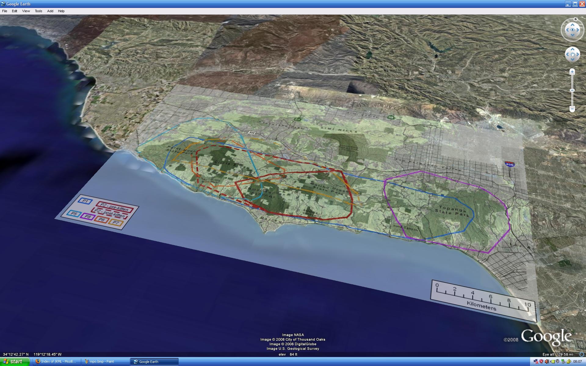
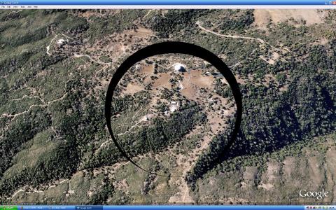
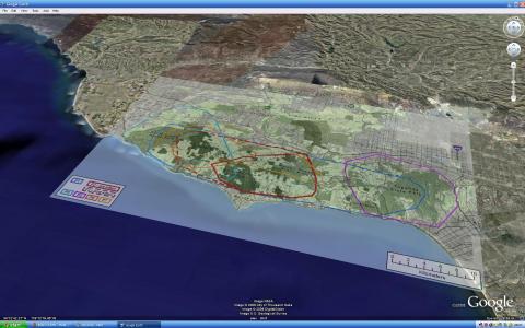
While not directly part of the HPWREN network,
http://anr.ucsd.edu/Viz/KML/SAMO-kittymap.kml is based on data
provided by an National Park Service collaborator to show, as an
image overlay, roam areas of mountain lions in the Santa Monica NPS
area.
|
|
|
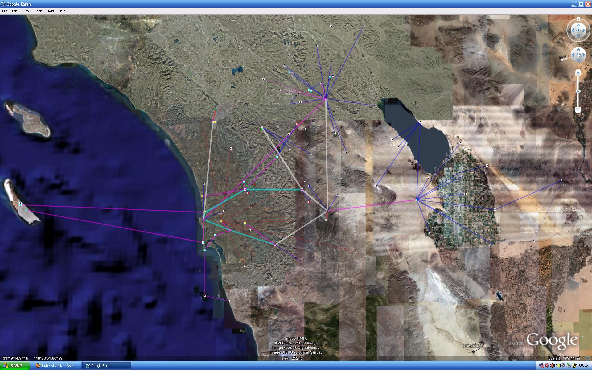
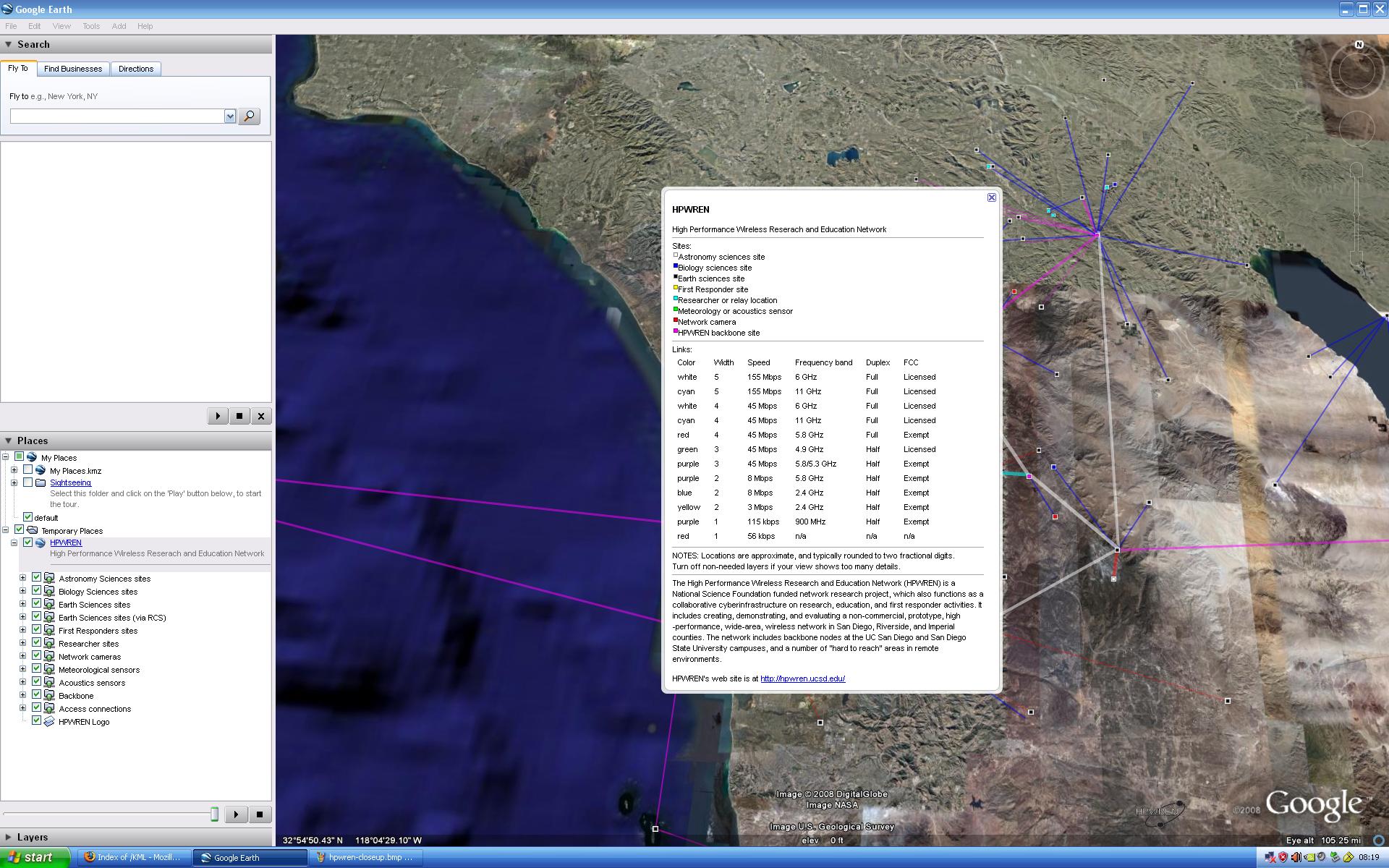
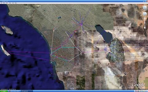
http://anr.ucsd.edu/Viz/KML/hpwren.kml tries to illustrate the
topological scope of HPWREN, showing its more that 200 mile west-east
extend. Also included are collaborator sites that utilize the HPWREN
network.
|
|
|
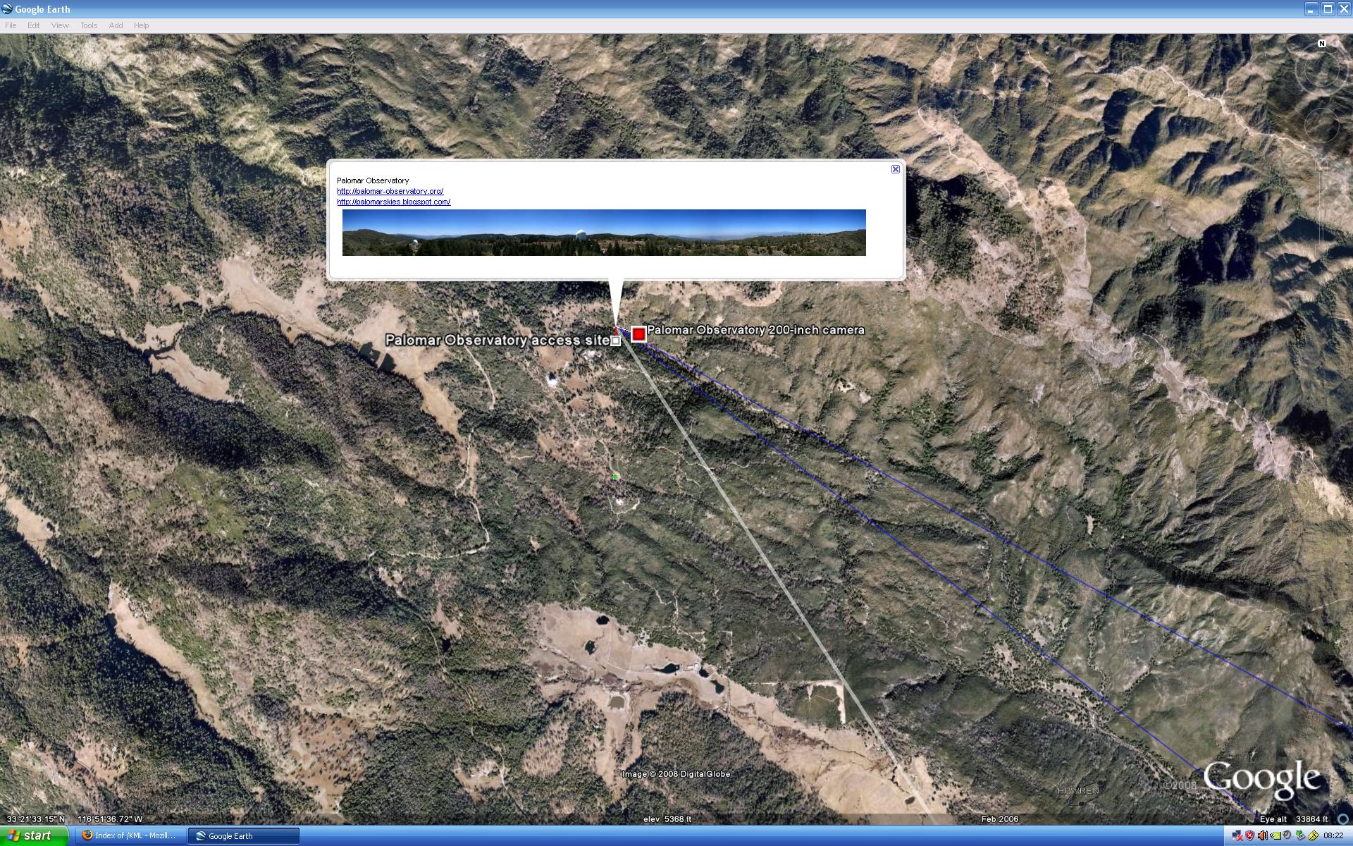
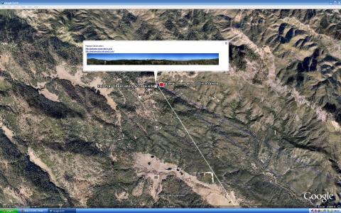
Closeup of the Palomar Observatory site, and how via a bubble an
overview photo and access to relevant web sites can be made available.
|
|
|
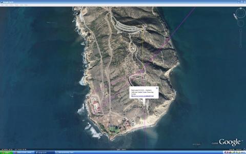
Closeup of Point Loma, with the NPS Cabrillo National Monument
tidepools on the left, and a Southern California Coastal Ocean Observing
System site highlighted by a bubble.
|
|